Goatfell, standing at 874m (2,867ft) above sea level, marks the highest point on the Isle of Arran and an iconic backdrop to the village of Brodick.
There are a number of different routes on Goatfell. None of them are particularly easy, as they all require a good level of fitness. However, this route I am sharing, is what I call the ‘easy’ route. It’s the most straightforward route up, without needing any technical mountaineering skills. That being said, you did need the correct hiking gear, as you are high up in the mountains on rocky mountain paths, and some previous mountain experience is ideal.
The full walk out and back is just over 7.5 miles.
Location
Goatfell is located just north of the village of Brodick, east of the island.

Parking
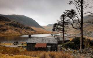
The walk starts at the Isle of Arran Brewery. You can park in their car park, or you can use the gravel car park, on the opposite side of the road.
SatNav: Cladach, Brodick, KA27 8DE

The Route
Follow this map, as you walk the route, and you shouldn’t get lost! Make sure your location is turned on and you should be able to see exactly where you are, on this map. Or if you prefer, download the GPX file and use it on your choice of route tracker.
1.
Starting in one of the car parks, head towards the Isle of Arran Brewery. You should see a path going off to the side, marked Goatfell.

2.
Take the path and follow it as it heads up through the trees and onto the open moors. Along the way, you will cross over several paths. At each path junction, keep heading forwards. If you are unsure at all, please refer to the map!


3.
Continue uphill along the path, all the way to the summit. As you get closer to the summit, the path will become steeper and rockier. This part of the route certainly challenges your fitness levels!


4.
As you climb your last steps to the summit, you will be greeted with a trig, and hopefully, 360-degree views, if the weather is on your side! The views up here make the steep climb up completely worthwhile!


5.
Once you’ve finished enjoying the views at the summit, start to make your way back down. Retrace your steps along the same path, all the way back to the car park, where you started the walk from. If you are unsure at any point, please refer to the map!


To watch the route in action, head over to our YouTube channel, The Adventurous Pair: https://youtu.be/NUPAi9ZnFyE
Enjoyed this walk? Why not have a go at one of my other favourites: Isle of Arran
Want to stay updated with new blogs? Don’t forget to subscribe by completing the form below!
(don’t forget to check your junkbox for the confirmation e-mail!)